
Trong dân sự, sinh mệnh đã được coi trọng thì trong quân sự họ càng cần được sự bảo vệ hơn bao giờ hết và trong mọi trường hợp, họ đều được trang bị những vũ khí tối tân nhất.
Bài sưu tầm này được gửi đến quý anh chị để tìm hiểu thêm ở thế kỷ 21, có những gì khác với thế kỷ trước đây.
Caroline Thanh Hương
Những công nghệ khủng Mỹ nâng cấp siêu chiến binh
http://baodatviet.vn/quoc-
Thứ ba, 22/03/2016 - 23:00
Bộ Quốc phòng Mỹ đang đầu tư những khoản tiền khổng lồ để tạo ra các siêu chiến binh.
Bộ Quốc phòng Mỹ (DoD) đang đầu tư những khoản tiền khổng lồ, tạo ra các siêu chiến binh, với những khả năng không tưởng như thần giao cách cảm, không biết đau...
1. Quần áo chống đạn làm bằng carbon
Các nhà nghiên cứu Mỹ mới đây đã thử nghiệm khả năng bảo vệ tiềm năng của graphene bằng cách bắn các hạt vàng li ti vào cho graphene.
Kết quả vật liệu này trở nên khỏe hơn, linh hoạt hơn, và nhẹ hơn so với áo khoác chống đạn hiện có. Tuy chứa hàng triệu lớp nhưng vật liệu này chỉ dày không quá 1 cm.
Graphene là vật liệu carbon có hình dạng mạng lưới lục giác kết nối các nguyên tố carbon giống tổ ong và độ dày của một nguyên tử carbon hay vật liệu 2 chiều.
Phân ban Công nghệ Nano Quốc phòng thuộc Viện công nghệ Massachusetts (MIT) hiện đang thử nghiệm một phương pháp sản xuất áo chống đạn Chainmail đi từ graphene, có khả năng chống đạn tốt hơn so với các loại áo chống đạn hiện có.
Chainmail (hoặc mail hoặc Maille) là áo giáp làm từ vòng kim loại được nối lại với nhau trong một mô hình dạng lưới bảo vệ. Có thể dùng cho lính thủy đánh bộ, nhất là nhóm phải làm việc trong môi trường khắc nghiệt, chống đạn lẫn bảo vệ trước nguy cơ tấn công của cá mập.
2. Máu tổng hợp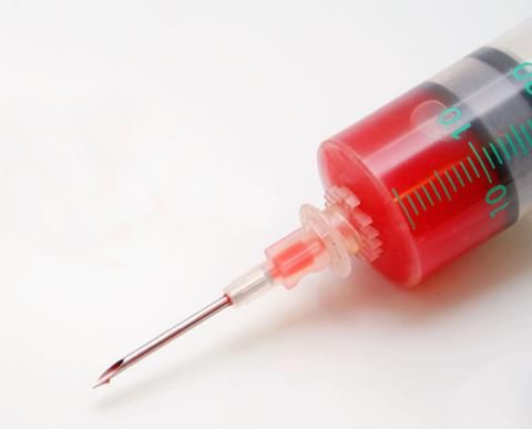
Máu tổng hợp (Synthetic blood) có hiệu quả hơn rất nhiều so với các tế bào máu tự nhiên. Một trong những công nghệ hứa hẹn nhất đang được DoD nghiên cứu là tế bào máu đỏ tổng hợp được làm từ kim cương có chứa các loại khí có áp lực gần 15.000 psi, có khả năng trao đổi carbon dioxide và oxy giống như cách các tế bào máu đỏ sinh học trong cơ thể con người.
Về cơ bản, siêu chiến binh mang trong người máu nhân tạo, pha trộn lẫn với máu tự nhiên sẽ có hàng nghìn tỷ thùng khí nhỏ liti bên trong cơ thể. Có nghĩa, không bao giờ mệt mỏi khi vận động, đặc biệt, có thể lặn hàng giờ dưới nước mà không cần các thiết bị trợ giúp.
3. Chiến binh có bước nhảy lớn, chạy cực nhanh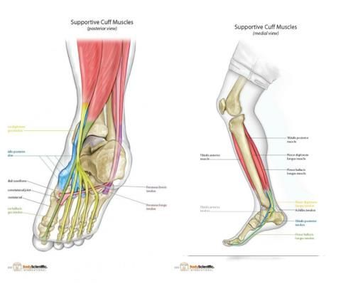
Viện MIT và một số trường đại học khác của Mỹ hiện đang phối hợp nghiên cứu, tăng cường sức khỏe mắt cá chân và gân gót chân để có sức mạnh giống như gân loài kangaroo.
Một khi con người được nâng cấp hệ thống khởi động như vậy sẽ có những bước nhảy vĩ đại, dài tới 7 feet (trên 2m) với tốc độ nước rút 25 mph (trên 40 km/h) hoặc hơn theo tốc độ phi con người, chạy cả ngày mà không bị tổn thương, rách cơ bắp.
4. Miễn dịch đau
Cơ quan Nghiên cứu Dự án Quốc phòng công nghệ cao thuộc Lầu Năm Góc (DARPA) hiện đang thực hiện dự án miễn dịch đau cho chiến binh có tên Persistence in Combat (Bền bỉ trong chiến đấu) nhằm nâng cấp chiến binh, giúp các chiến binh khi bị thương, các vết thương có thể phục hồi ngay tức thì.
Việc miễn dịch đau sẽ có tác dụng trong khoảng thời gian 30 ngày và có khả năng loại bỏ tình trạng viêm nhiễm gây đau đớn kéo dài hậu chấn thương.
Sau miễn dịch những người lính được nâng cấp này có cảm giác như sắp nổ tung vì đau đớn, nhưng cơn đau sẽ qua mau trong vài giây. Bằng cách này, các binh sĩ có thể tự điều trị bản thân và tiếp tục chiến đấu cho đến khi quân y tiếp viện.
5. Ngủ tự do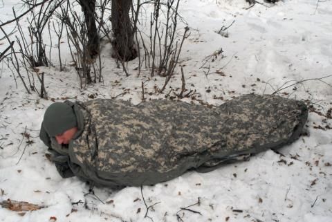
Không phải tất cả các động vật ngủ cùng một kiểu, nên biết được nguyên lý này DARPA đang bắt tay vào nghiên cứu tìm cách để cho con người ngủ một cách tự do.
Ví dụ ngủ chỉ bằng một nửa bộ não tại một thời điểm nhất định như cá voi và cá heo hay thậm chí có thể bỏ qua giấc ngủ trong thời gian dài như chuột ENU, loài vật gậm nhấm được chuyển gen.
6. Telepathy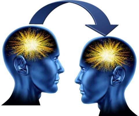
Telepathy là thuật ngữ nói về thần giao cách cảm, tức khả năng đọc ý nghĩ người khác hay trao đổi thông tin trực tiếp giữa các bộ não. Nó là một trong bốn hiện tượng ngoại cảm, bao gồm thần giao cách cảm, thấu thị hay thấu thính, tiên tri và hậu tri.
Một dự án mang tên Brain Machine
Interface của DARPA đang thực hiện nhằm phát triển các chip máy tính kết
nối trực tiếp với não con người thông qua cấy ghép. Ngoài việc cho phép
binh sĩ điều khiển robot bằng suy nghĩ, dự án còn cho phép các binh
linh Mỹ giao tiếp thông qua thần giao cách cảm.
Coogn
nghệ chip đã được cải thiện đáng kể nên tính khả thi của dự án rất cao.
Ví dụ, người ta đã cấy vào não chuột những con chip kiểu này và điều
khiển từ xa, tuy nhiên các nhà khoa học cũng lo ngại nguy cơ tâm trí của
các siêu chiến binh sẽ bị tấn công bởi chính các tiến bộ công nghệ tiên
tiến hơn.
7. "Bộ xương mềm" 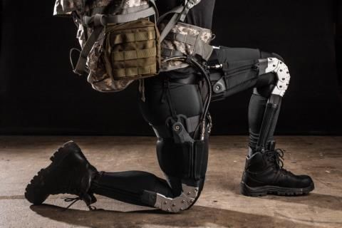
Các
chuyên gia Harvard đang thực hiện dự án "bộ xương mềm", hay bộ đồ robot
do DARPA tài trợ vốn. Thực chất đây là một loạt các cơ vải mặc bên
trong quần áo thông thường để giúp con người chuyển động. Đặc biệt, nó
làm giảm mệt mỏi và tăng sức mạnh mà không đòi hỏi năng lượng cồng kềnh,
khung xương cứng nhắc như các bộ khung kim loại.
8. Găng tay và giầy leo trèo như tắc kè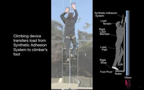
Tắc
kè sử dụng sợi lông nhỏ xíu trên đôi chân của chúng để bám vào các bề
mặt ở mức độ phân tử. Dự án có tên "Z-Man" do DARPA đang thực hiện,
không nhất thiết phải cung cấp cho con người khả năng leo trèo trần nhà
như tắc kè, nhưng nó sẽ cho phép binh sĩ có thể leo lên mặt núi đá hay
leo lên tòa nhà chọc trời mà không cần phải dùng đến bất kỳ thiết bị trợ
giúp nào.
Với các các trang bị này, chiến binh có
thể mang trên người vật nặng tới 1 tạ nhưng vẫn có thể vượt qua các
chướng ngại vật một cách dễ dàng.
Ngọc Anh


